

So What Happened?
The January 2026 winter storm's northward shift

The following is our monthly deep dive for paid subscribers. As always, the rest of WWAT will remain free. All revenue supports the AMS’ Education Department and keeps this going.
The late January 2026 winter storm of North America (nicknamed “Fern” by The Weather Channel and absolutely no one else) was a big deal. It was hyped up more than Al Capone’s Vault and, unlike said vault, mostly lived up to that hype.

So why are meteorologists taking hits like Amare Stoudemire’s fire extinguisher?

Some folks are incensed that the storm tracked a little farther north than the early forecasts. Yet most people still saw enough snow and ice to justify the cost of the shovels and the French toast supplies they rushed out to buy. But a smaller, louder group never got to peel the plastic off their shiny new snow shovel and now finds itself sitting on a surplus of beer for the rest of the winter. Those are the angry ones. The beer probably contributing.
Let’s look at the science behind the storm, so we can decide who to properly blame. Because casting blame is the American Way - as was science, once upon a time.

Out of the Gate
The origins of the storm lay in a weak polar vortex, abundant Gulf moisture across the South, and a low-pressure system approaching Baja California. This system was unusual enough that the National Weather Service flew hurricane hunters into it to take key measurements, something they rarely do for Pacific storms at this time of year. And, sure enough, they found the low-pressure system to be abnormally strong.

As it moved across Mexico and the southwestern United States, forecasters sounded the alarm. Combining computer models with their own experience, they saw all the ingredients of a significant winter storm in a region that rarely sees them.
The low pressure was predicted to move across Texas and tug down the southern edge of a rare polar vortex that had already extended into the Great Plains and Midwest. This provided the cold air. At the same time, ample moisture was moving northward from the Gulf (of México or America, depending on your choice of headgear). Now we had the all the energy (the low-pressure system), cold (the polar vortex), and moisture (from the Gulf) needed for a fun winter storm.
The Forecasts
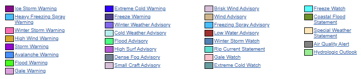
Let’s start with a map of watches, warnings, and advisories1 issued by the National Weather Service on Friday, January 23rd when the first frozen precip in Texas and Oklahoma began to fall.2

Now let’s look at the snowfall (l) and ice (r) reports from January 24-26, when the storm crossed the country.

Comparing the forecast (top) and the realized (bottom) maps shows that the forecast was reasonably accurate, though the storm did end up slightly further north than expected. In particular, areas of Georgia and eastern Tennessee received less winter precipitation, whereas areas of Illinois and Michigan received more. Most people were pretty happy with the forecasts they were given. But, especially in those southern areas, some were not.3
Trends are Your Friends
I recall watching the various weather channels on Thursday and seeing this northern trend appear in subsequent updates. I was staying with friends in East Texas and needed to drive to Houston the next day. We were already on the ice line, so a slight move north or south could make or break my trek. One of the presenters said that this type of northern movement of a winter storm forecast was common in them there parts.
I was able to make my 3-hour drive on time. And while I tried to keep my mind trained on more important things like bathroom breaks and the upcoming NFL Championship Games, the presenter’s comments kept creeping in. And it bothered me. If this is common, then why didn’t they account for it?
Causes of a Northward Shift
Let’s look at what caused that northward shift. First, as the polar vortex moved south it merged (i.e. phasing in scientific terms) with the low pressure system from the Pacific. This strengthened the system and pulled up warmer air from the Southeast. Sometimes this phasing doesn’t happen and the systems remain more independent, which would lead to a more southern track.
Next, as moisture from the Gulf feeds into the storm, condensation and freezing release latent heat, which subtly warms the middle layers of the atmosphere. That warming helps deepen the low pressure system, tightening its circulation and allowing it to strengthen. A stronger storm does not just get bigger, it also becomes more responsive to the larger atmospheric flow around it. Once that happens, small changes in where the temperature boundary sits can nudge the track farther north than early forecasts suggested.

Why northward? Midlatitude cyclones live off temperature contrasts where cold air sits to the north and warm air to the south. This contrast is their life force. As the storm intensifies, it aligns itself with the strongest part of that gradient and the nearby jet stream, which in southern winter setups is often positioned slightly poleward. The differences involved are small, but these storms are enormous. So even small changes are magnified and can translate into a noticeable northward wobble.
If it always happens, why don’t we account for it?
The process is well known to both experienced forecasters and also the computer models. However, to properly account for it we need specifics in the form of data. Recall that this system began off Baja California. Very little atmospheric data is routinely collected there. (All sorts of surprises routinely come out of that area of the Pacific for this reason.) There are no consistent balloon launches or ground stations reporting conditions there (hence why NOAA needed to fly a a hurricane hunter into it). Once the system entered the United States, more atmospheric data came in and the models/meteorologists updated their forecasts accordingly, moving it slightly northward.
Another example regards where the precipitation forms. If more of it forms on the front/right side of the storm, as is common in these types of storms, then it also can cause the storm to veer north. But we won’t know that until the first precipiation falls - and that won’t happen until the system meets the Gulf moisture (in this case over Texas and Oklahoma).
So even though we understand the mechanisms, we need real data before we can truly plan for it. And, to paraphrase Aaron Burr, we had to wait for it.
In the end, the storm was well forecasted for most. Of course, it wasn’t perfect. And, really, would you want the weather to be perfectly forecasted? We would lose the most common topic of small talk. And if, like me, you have locubrevisphobia, that would be a hell worse than opening an empty vault in front of 30-million people.

We acknowledge additional contributions by Alan Gerard.
Weather with a Twist is published by the American Meteorological Society.
* During the preparation of this work, the author(s) used ChatGPT-5.1/5.2 to copyedit and help with phrasing. WWAT’s author(s) reviewed and edited the content as needed and take(s) full responsibility for the content of the publication.
Image legend:
I grew up in the south but have lived most of my life in the north. It’s funny how winter storm busts are considered good news up here while it disappoints/angers those down there.
Fascinatin breakdown of the northward shift. The part about needing real-time data from Baja makes sense, but it's wild how much that data gap affects downsteram forecasting. I remember tracking a similar pattern shift and thinking the models were just off, turns out sparse initial conditions were the culprit.
Thanks for this. I admire the way you merge the synoptic with the local. FYI, the forecasts made for Northern New Mexico on this storm were a spectacular bust .... blizzard-to-mild-sunny-afternoon bust. Wonderful example of the principle of the Least Regret Forecast leading forecasters wildly astray.