


Lake Effect Winter Lightning
Hunting Thundersnow

Thundersnow is the holy grail of winter storm lovers. Any weather nerd worth their salt would even cancel a romantic date for a chance of thundersnow. Or, better yet, suggest to their partner that instead of going out, they stay in. Make thundersnow and chill a thing.
Thundersnow is lightning occurring within a snowstorm, and it’s undeniably fascinating, primarily because of its rarity. It’s also captivatingly beautiful—lightning flashes take on a cerulean blue hue, and as they reflect off airborne snow, the light diffuses across the entire sky.
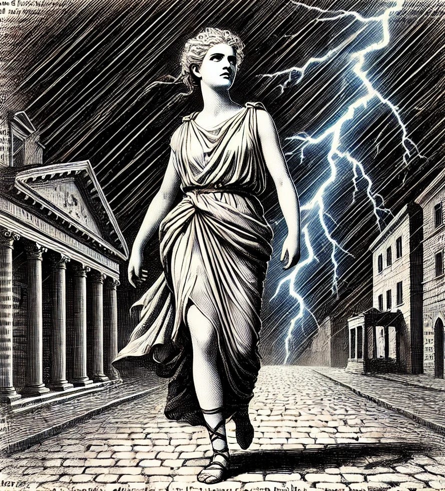
Even Shakespeare understood the symbolic importance of blue lightning. In Julius Casesar, Cassius taunted a frightened Casca with:
"For my part, I have walk'd about the streets,
Submitting me unto the perilous night,
And, thus unbraced, Casca, as you see,
Have bared my bosom to the thunder-stone;
And when the cross blue lightning seem'd to open
The breast of heaven, I did present myself
Even in the aim and very flash of it
- Julius Caesar, 1:3
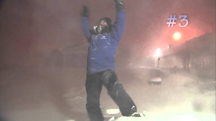
In her own somewhat twisted way, Cassius was saying that openness and honesty were the only antidote to a cruel world. And while Shakespeare knew drama in the 17th century, only Jim Cantore knows drama in the 21st century. Behold (and turn down your speakers):
Lake Effect Lightning
Children are taught to avoid standing near tall structures during a lightning storm—and for good reason. Tall objects attract lightning because they intensify the local electric field (especially pointy-shaped things), reduce the distance to the cloud base, and offer a lower resistance path for the electrical discharge. Like much in nature, lightning bolts are lazy.
Humans continue to build tall things—things that attract lightning, such as wind turbines. The scientific term for lightning striking objects taller than 100 meters is tower-initiated lightning. The strike usually begins in the clouds and travels downward to the tower. However, in some cases, it originates at the tower and shoots upward, often branching out like a tree.

The Atmospheric Blues
Lightning is caused by the buildup and release of electrical energy within a storm cloud or between a cloud and the ground. Inside a cloud, ice particles such as graupel and ice crystals collide, creating electrostatic charges. Graupel, being heavier, tends to precipitate and contribute to the middle and lower charge layers, and ice crystals, being lighter, will be suspended at middle and upper levels.1 These layers can have different polarity. This separation of charges creates a strong electric field. When the electric field becomes strong enough to overcome the insulating properties of the air, lightning leaders propagate into regions of opposite polarity and create lightning channels that act as plasma, heating up the air around it to about 30,000 °C (54,000K °F). The superheated air around this tube expands explosively, creating thunder. And causes meteorologists to dance in the snow.
Lake effect snow storms are caused by cooler air moving over warm water. The water warms the lower levels of the air, causing it to rise and generate updrafts. As the air cools, the water vapor condenses and freezes, falling as snow. Lake effect snow storms can be intense in part because the air is so humid. It also has higher concentrations of mixed-phase hydrometeors (supercooled liquid water, graupel, and ice crystals) due to the intense updrafts. This creates an ideal environment for non-inductive (NI) charge separation, the aforementioned mechanism for cloud electrification.
So if you want to study thundersnow (and who doesn’t?), then lake effect snow storms are great. The eastern side of Lake Ontario happens to be the snowiest place east of the Rockies. And the area near the Tug Hill Plateau has another bonus: over 300 wind turbines taunting the lightning gods.

So we have the potential for highly convective snow storms plus lots of pointy towers. But what happens if a turbine is struck by lightning and no one sees it? That’s right, nothing at all. So we need people to observe it.
Enter a research team led by Dr. Scott M. Steiger (State University of New York at Oswego). He led the NSF-funded Lake-Effect Electrification (LEE) field campaign to measure the total lightning and electrical charge structures of lake-effect snow storms in the winter of 2022-2023. The team included dozens of scientists and 24 undergraduate students. They also had support and help from volunteer local residents who offered them access to private property, acted as field guides, snow plow drivers, and more. To give back, the research team held open houses to share results with the community and brought the DOW7 to many local elementary schools.
They collected data with a lightning mapping array (LMA), balloon-based soundings, and our old friend the Doppler on Wheels (specifically DOW7).

Much to the dismay of children, snow plow operators, and believers in home-field advantage - the winter of 2023-2024 was the least snowiest for that region since 1926. But they still managed to snag 11 lake effect snow events from November 2022 through early February 2023.
When a potential lake-effect snow event was forecasted, the team followed a well-defined protocol. At 96 hours before the event, they went on standby—essentially dropping everything to "test equipment" (which may or may not have looked like playing video games while waiting for the phone to ring). At 48 hours, a go/no-go decision was made based on the latest forecast models. The final 24 hours were spent assigning tasks and mapping everything out. Then, it was showtime.
Of the 11 monitored events, 7 produced no lightning at all (cue sad trombone). However, in the remaining 4 events, they measured an impressive 246 lightning flashes (somewhere, Jim Cantore is fainting). About 33% of these flashes were associated with wind turbines.
Take a look at the graphic below. Their combined efforts contributed to this conceptual model of lightning and the electrification structure in lake-enhanced snowstorms. We’ve published over 40 WWATs at this point, but this might just be one of the most well-designed and informative graphics I’ve seen in a research paper.

One way to read this is to follow the surface from left to right. The lake is on the left, followed by the shore, then the coastal plain, then hills and wind turbines on the right. As the wind blows from left (west) to right (east), the warm water over the shore generates the initial updrafts, and different types of hydrometeors form (graupel, snow, and other ice crystals).
Near the shore, graupel carries a positive charge as it precipitates, supported by intense convection fueled by the warm lake surface. Farther inland, as the graupel precipitates out, a dipole forms: positively charged ice crystals remain aloft, while graupel and snow carry a net-negative charge closer to the surface, extending up to 50 km inland. Stratiform cloud bands farther inland create more horizontally extensive charge regions near the surface, enhancing the electric field and occasionally initiating upward lightning discharges from tall structures like wind turbines. This finding revises earlier dipolar models of lake-effect snow storms by identifying a lower positive charge layer near the shore.
An important operational lesson learned was how to improve weather balloon launches in cold weather. Low temperatures made some equipment sharp, leading to frequent balloon ruptures during launch. Their solution? Keep the equipment warm and insulated inside vehicles until just before launch.
They also faced challenges retrieving equipment that landed in heavy snowdrifts, with some instruments buried beneath more than a meter of snow. In some cases, they relied on snowmobiles—and assistance from local residents—to recover the equipment. Despite the challenges, they successfully retrieved every launched balloon instrument.
This impressive research study will help meteorologists better understand lake- and ocean-effect snowstorms and their associated lightning. The findings have implications not only for wind turbines, towers, and other tall structures on land but also for ships at sea, which are similarly vulnerable to lightning strikes during these storms.
And Now for Something Completely Somewhat Different
Below is thundersnow as seen from space. On December 4, 2024, the Geostationary Lightning Mapper on the GOES-East satellite tracked lightning that started in a Lake Michigan snow squall and moved across southern Michigan.
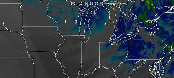
Click here for a more gorgeous animated GIF that tracks the squalls all the way into the mid-Atlantic. It’s a beautiful series of images that are of such a high-resolution that Substack wouldn’t allow me to embed them.

These images come courtesy of the Satellite Liaison Blog. If you are into weather satellite technology, it’s a terrific read. It’s by and for the professionals who operate and use the satellites and provides cool insight into their calibration and operations. It can be hard to decipher at first, but like any foreign language, it starts to make sense over time if you stick with it.
We acknowledge additional contributions from Dr. Milind Sharma.
Please share, favorite and do all the things to help spread the WWAT word!

I've been fortunate enough to experience thundersnow a handful of times, and each was spectacular (cue Jim Cantore). My students especially enjoy that video compilation!
Jim Cantore going bonkers ("you gotta be kidding me") was classic but I especially enjoyed the science in the rest of the article. WWAT is the best meteorological science Substack out there!