


Thunderstorms, Interrupted
Why do some reach for the sky while others chill down low?

Watching a rising thunderhead is a rite of passage for any weather nerd lucky enough to live in the Plains or the southern U.S. On especially hot, sticky days, if you lie still on the grass and focus on the bulging top of a thunderhead, you can actually see it grow and build out.
Sometimes the clouds reach the tropopause, where the temperature stops decreasing (temperature inversion).1 This acts like a lid on their vertical growth, causing them to spread out sideways. If strong winds are present, they can blow the cloud tops downwind, forming the classic anvil shape. As a kid in Texas, I once saw multiple anvils heading our way at the same time and felt a profound sense of nature’s power. It was an uncanny mix of dread and excitement, like hearing your favorite childhood band is going on tour again and calling it The Knee Replacement Tour with a new lead single called “Arthritis”.

Convection and Entrainment
Convection is the process by which warm, moist air rises into the atmosphere, cools, and condenses to form clouds. When this rising air is strong and sustained, it can lead to the development of cumulonimbus clouds and ultimately produce thunderstorms.
In a thunderhead, the air speeds up as it rises, especially through the lower and middle parts of the storm. This happens because the rising air is warmer and less dense than the surrounding atmosphere, giving it positive buoyancy like a hot air balloon accelerating upward. As the air continues to rise and condense, latent heat is released through condensation, further warming the air parcel and sometimes even accelerating it.

Now imagine a column of air rising. As it ascends, the edges of the column mix with the surrounding air, due to turbulence around the cloud edges, which is usually cooler and drier. Some of that outside air gets pulled into the storm and gets caught in the main updraft. This slows down the convective process. Meteorologists have a cool name for this: entrainment.


Entrainment is detrimental to storm updraft intensity because it dilutes the updraft boyancy, mixing less bouyant air with the updraft core. This attenuates the upward growth of the storm.
Substack is warning me I’m going to run out of room for this issue and I haven’t even got into the research yet. Maybe drawing fake promotional posters is the entrainment to my writing process.
The article that caught my eye this week while perusing the AMS journals is this new study by Jo, et al. (2025) in Journal of the Atmospheric Sciences. It takes a deep dive into convective clouds and the role entrainment has on deciding which storms make it big.
The Experiment
There are three laboratories for atmospheric research. First, you have the human mind where thought experiments ponder questions like “What would happen to the Wizard of Oz tornado if 300 cows flew through it?” Second, you have the actual sky. But that takes a lot of resources and flying skill to run an experiment there. Third, you have computer simulations, which are cheaper but only as good as we program them to be.
Most research on entrainment take the third route. But those simulations tend to be simplified - focusing on the cloud physics and not as much as the context around the clouds. They will take into consideration the chemistry and physics of the air parcels in the clouds but usually not so much as what’s going on around it - things like the presence of other clouds, the surface of the earth, debris (like 300 flying cows), or other nearby clouds. This study used all 3 laboratories. They imaginatively identified a problem and a solution, and then used real world data combined with a simulation to test it.

CACTI
The team used real world data from the U.S. DOE-funded ARM CACTI field campaign (Cloud, Aerosol, and Complex Terrain Interactions) conducted over the Sierras de Córdoba in central Argentina. This region is a sort of atmospheric obstacle course: strong sun, dramatic terrain, and plenty of convective action.

They fed the data into simulations of cloud formation using LASSO, a system that simulates large eddies in the atmosphere around given points. The data came from over 2,000 monitored cloudy updrafts that developed across four days - two days of “meh” conditions for convection (as measured by CAPE) , and two “bring it on” days with better conditions. Think of CAPE as the energy stored in the atmosphere for storms. High CAPE? Explosive potential. Low CAPE? A gentle simmer.
Then they got down to business, tracking which clouds soared and which stayed shallow, and measured all sorts of variables: updraft width, wind speed, humidity (bah), buoyancy, and of course, rate of entrainment. They used a statistical technique, linear regression, which allows them to estimate the level of importance of each (independent) variable in the formation of supercells (the dependent variable).
Its Complicated, but Relative Humidity is King
Yes, they found entrainment-limited convection. That’s not new. But what the study contributes is exactly which characteristics of the cloud environment are most important (incl. entrainment). The answer?
Relative Humidity (at midlevel altitudes2) – As much as I hate to heap praise on my mortal enemy, relative humidity is the MVP. Moist air around the cloud means less evaporative cooling when that air gets entrained.
Impact: 42% of cloud-deepening predictability.Low-level CAPE – The power under the hood. More energy in the lower cloud layer gives the updraft a better shot at survival.
Impact: 28%.Updraft Width – The wider the base of the updraft, the less susceptible it is to dilution. Narrow updrafts entrain proportionally more dry air.
Impact: 19%.Entrainment Rate (ε) – The rate at which surrounding air is pulled into the updraft. High ε = more dilution = sad cloud.
Impact: -11% (yes, that’s a minus sign).

In short: Using more realistic simulations, the researchers found that the dryness of the air being entrained into a storm has the greatest impact on the storm’s eventual growth. In fact, the moisture content of the entrained air matters more than the amount of air being mixed in. This will have implications for modeling and predicting the growth rate of convective cells, a key element in thunderstorm forecasting.
And Now for Something Completely Different
Okay, we asked the question earlier. “What would happen to the Wizard of Oz tornado if 300 cows flew through it?” We can’t leave that hanging or else it will wake us up at 2am in the morning. So let’s answer it.
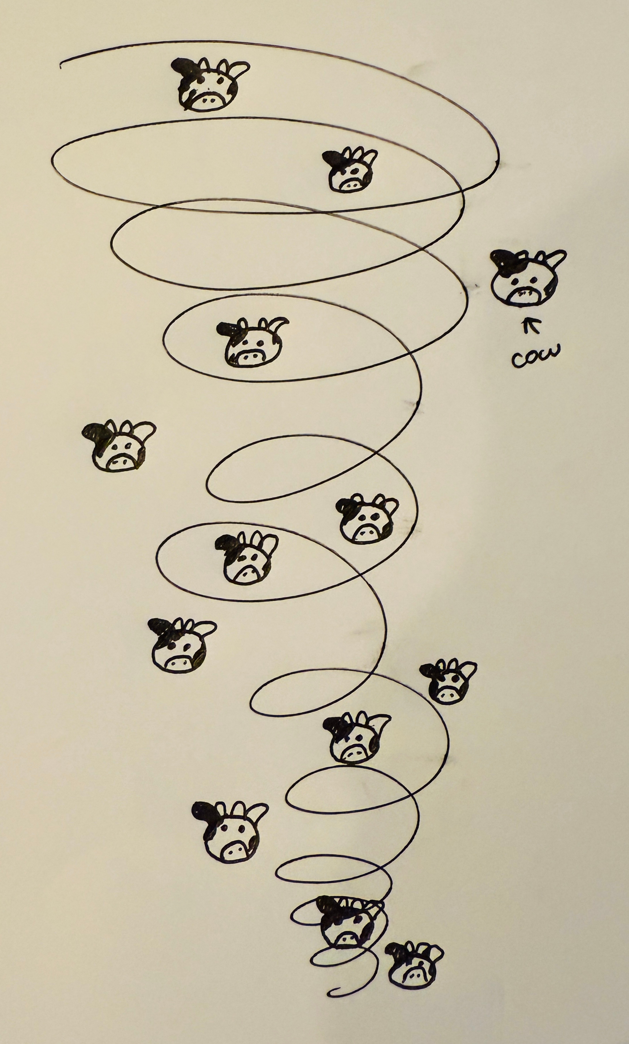
Let’s assume the average cow weighs 1,400 lbs. 300 cows is almost half a million pounds of beef. Converted to kilograms (because science is like that) that’s 190,512 kg.
The gravitational potential energy to lift the cows can be expressed as E = mgh:
E = 190,512kg × 9.81m/s^2×100m ≈ 186,835,512 joules That’s 186.8 megajoules just to lift the cows vertically.
A strong tornado (EF4–EF5) has total energy on the order of 2,000,000 megajoules, depending on size and duration.
This means lifting the cows would use:
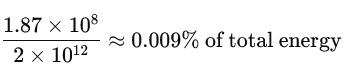
So the impact on the tornado? Not much. But the impact on the cows? It’d be an udder catastrophe.
We acknowledge additional contributions from Dr. Milind Sharma, Chris Nabholz, and Beth Mills. We are grateful to (and apologize to) Lockheed Martin for a grant to support this newsletter.

Our archive of WWAT articles is here.
During the preparation of this work, the author(s) used ChatGPT-4o in order to copyedit text, draw the mock posters, and do the cow math. After using this tool, WWAT’s author(s) reviewed and edited the content as needed and take(s) full responsibility for the content of the publication.
and may even start increasing
13-15,000ft
Fascinating, thank you !
So pleased to have found you. Witty fun and fascinating.