Phased Array Radars
Chasing tornadoes with electromagnetic radiation
Tornadoes come and go like a thief in the night. Issuing warnings via radar can be like playing a game of whack-a-mole. One minute they are HERE. And another minute they are THERE. Like a space in a crowded parking lot, close your eyes and it's gone. Where’d it go? No one knows.
Their potential for destruction and elusive nature is a pretty terrible combination. And while we can’t do much to limit the former, we can continually improve our forecasting technique to nibble away at the latter.
Phased-Array Radars
Other than the human eyeball, radars are probably the best tool meteorologists have for nowcasting and monitoring tornadoes. And they are about to get even better.
Phased-array radars represent the next generation of meteorological radar technology. The acronym is technically PAR, but I think the phrase “phased-array radar” sounds intrinsically cool and thus it’s a crime against humanity to hide it behind a cold acronym. It’s like referring to vinyl as “records”. You’d likely get beat up for that. And out of solidarity with everything cool, and not wanting to get beat up by roving bands of hipster weather enthusiasts, I will refer to it as phase-array radar - as nature intended.
Traditional radars operate by bouncing beams of electromagnetic radiation off objects in the atmosphere. Because these beams are narrow, radar dishes must rotate to scan the sky. Once upon a time, a weather radar looked like this:
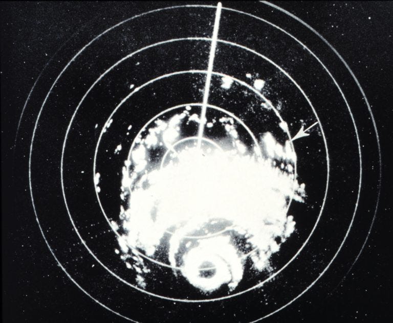
This rotation limits the spatial and temporal resolution of the data, requiring meteorologists to be strategic in how they control the beams to maximize their effectiveness. For example, they can adjust properties such as the radar’s antenna’s rotation speed and elevation (up/down angle). However, there are consequences. For instance, raising the antenna’s elevation angle allows for observations of precipitation higher in the atmosphere but reduces visibility of features closer to the ground. Also, slower antenna rotation rate can provide more accurate data, but a tornado could move or change intensity between successive scans. This time lag is critical in situations where minutes can mean the difference between life and death.
Hold Still for a Second
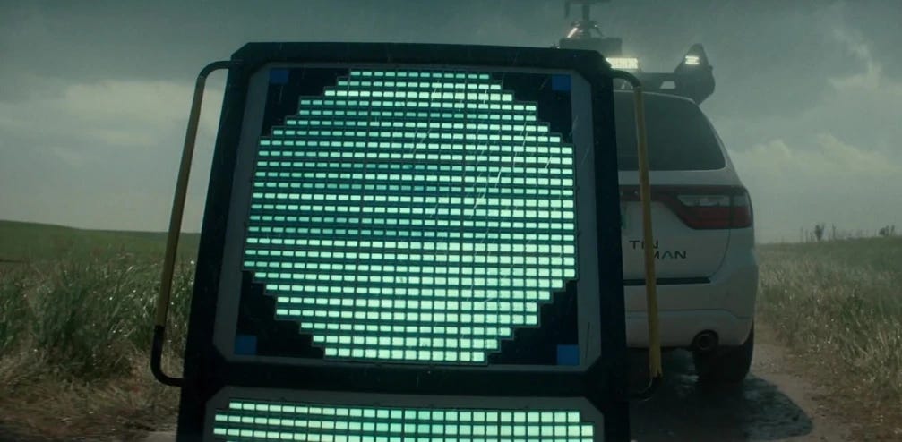
Phased-array radars don’t rely on a single rotating antenna. Instead, they have many small, fixed antenna elements arranged in a grid. With apologies to Hollywood, this is not what a meteorological phased-array weather radar looks like:
THIS beast is what a meteorological phased-array radar looks like:
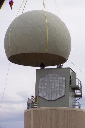
Each element can transmit and receive signals independently. The radar system manipulates the timing (or phase) of the signals sent from different elements. By adjusting these phase differences, the radar can steer its beam electronically without physically moving the antenna.
Since the beam direction can be changed almost instantaneously, the radar can scan an entire storm system in seconds rather than minutes. It can also scan multiple heights and regions at the same time, enabling a more detailed 3D view of the storm.
It’s Not Only a Phase
So how does it work in practice? A research team led by Vincent T. Wood (National Severe Storms Laboratory - NOAA [retired]1) recently published a paper in the AMS Monthly Weather Review journal describing an analysis of the May 31, 2013 tornado near El Reno, Oklahoma using the rapid-update SPY-1A phased-array radar. NOAA’s National Weather Radar testbed is in Norman, OK, where new technologies are experimented with long before they are deployed nationwide.

This was a special tornado. Depending on how you measure it, it may be the widest tornado ever recorded. It also displayed multiple vortices, one of which circulated around the main tornado and then was absorbed by it.

The researchers analyzed rapid-scale data of the supercell collected from a single-polarization S-band SPY-1A phased-array radar antenna located in Norman. This was a test radar donated by the US Navy, which has been using phased array radars aboard some of their ships for over half a century now.
They scanned the tornadic supercell for approximately 48 minutes using four elevation angles. During this time, they measured a horizontal slice of the atmosphere about 1/3 km to 1/2 km above the radar level around the tornado (depending on its distance from the radar as it moved across the field). The average scan interval was ~1 minute, providing much more rapid sector volume updates compared to the ~5-minute interval of current NWS WSR-88D radars in their default configurations.
The rapid scan updates enabled the researchers to observe large circulation and convergent flow (inward wind flow) just before the tornado’s formation, as well as more divergent flow (outward wind flow) as its size increased. The paper details their methodology for measuring flow direction and rates. The physics is complex - the paper contains more Greek letters than the Athens post office. However, the main takeaway is that the additional data allowed them to detect tornado precursors, like quickly changing flow rate and direction, that operational dish antenna radars cannot.
More Trucks with Radars
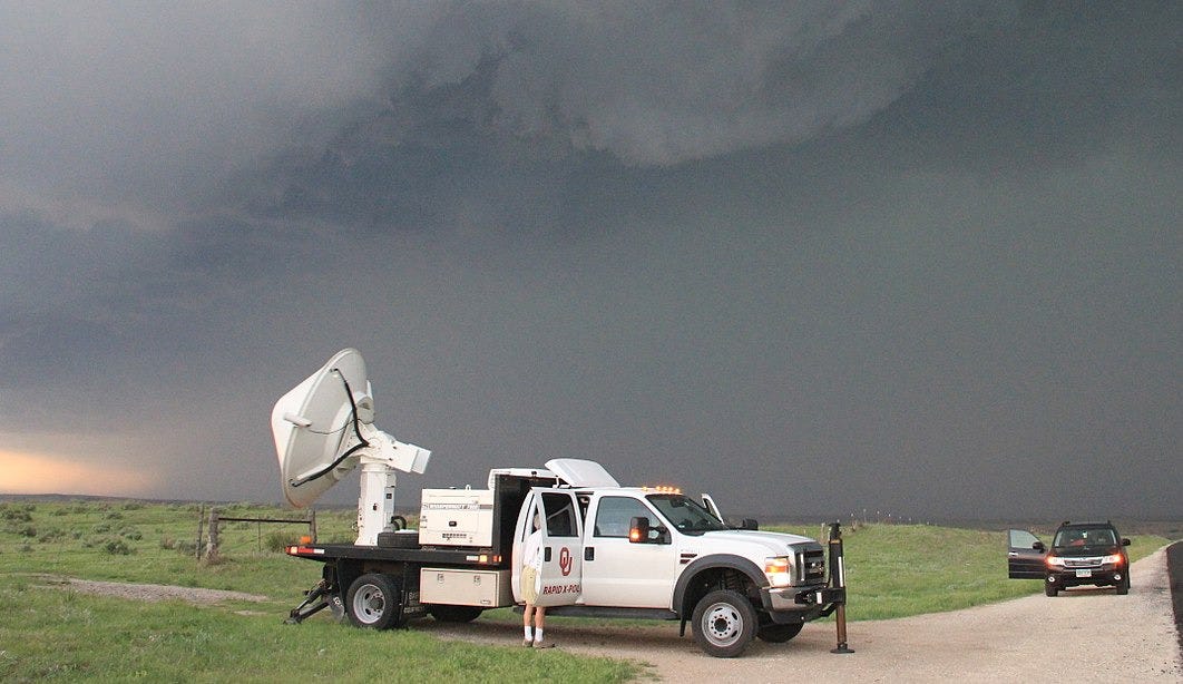
The RaXPol mobile radar was also monitoring the tornado from a very close location (so close that, for safety, they had to move away at one point), allowing them to observe the base of the tornado, which is often blocked from radars by the horizon.
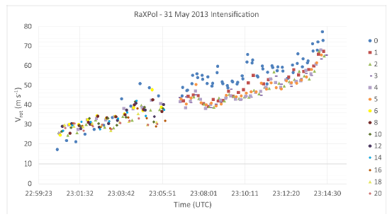
Below is a plot of the rotational velocity over time, as measured by RaXPol. Each color represents a different elevation angle, corresponding to different heights above the ground. Initially, the vortex rotated at roughly the same speed across all heights. Over time (around 23:05), it became more organized, and different layers began to rotate at different speeds. This can be a sign of intensification, including the development of multiple vortices, particularly if the higher levels are rotating faster than the lower levels.
Now look at the following plot. This shows the overall rotational velocity from the RaXPol mobile radar vs. the SPY-1A phased-array radar. Note the phased array-derived rotational velocity (orange dots) matches well with RaXPol-based rotational velocity (blue dots). This is a sign that, in this case at least, the phased-array radar was able to detect rotation as well as a mobile radar perched just a few kilometers away from the tornado. If this is confirmed and consistent, it could be a huge advantage in future radar-based real-time monitoring of tornadic and nontornadic supercells.

Tornado Debris Signature
One way tornadoes are confirmed via radar is through their Tornado Debris Signature (TDS), which is radar reflectivity caused by debris lifted by high winds and is associated with other tornadic signals. The debris circulates within the tornado and appears distinct from precipitation on dual-polarization radar. Tornado circulation is maintained by a cyclostrophic balance between the radially inward-directed pressure gradient force and the radially outward centrifugal force. This dynamic keeps debris trapped in the rotation, but occasionally, larger debris is parabolically ejected outward and falls once outside the core of rotation.
These debris ejections can sometimes be identified on radar reflectivity and velocity images as transient signatures separate from the main circulation. This can create a velocity signature that appears as wind moving away from the tornado, even when it is simply an artifact of the debris field. Such a signature can sometimes give a false impression that the tornado is weakening.
In this case, the tornado primarily moved through open fields (as many do), meaning there was limited debris available to be lofted into the air. As a result, any outflow detected by radar is unlikely to be caused by debris and may instead indicate either 1. actual wind moving away from a weakening or redeveloping tornado or 2. the presence of multiple vortices rotating around it.
Another advantage of phased-array radar is its ability to measure the vertical structure of a tornado. Stronger tornadoes tend to remain more vertically aligned, while weaker or dissipating tornadoes often exhibit a tilted or bending structure. Scanning a larger portion of the tornado’s length in near real-time allows meteorologists to assess its vertical evolution and intensity changes better.

Think phased-array radars are interesting? Just wait until we tell you about the next technological leap beyond that - Multi-function Phased Array Radar (MPAR2). It’s coming.
And Now for Something Completely Different
Conan O’Brien has gone through many ups and downs in his career. Clearly, right now he’s riding high after a well-received performance at the Academy Awards. He also has a podcast, Conan O’Brien Needs a Friend, which has been a big success. The podcast alternates between celebrity interviews and calls with random fans, who mostly talk their jobs. Conan’s ability to do a high-energy riff on just about any topic is thoroughly tested when someone’s job is to fix bicycle tires.
Last week’s interview was with Max Mueller, a broadcast meteorologist in Fargo, N.D. Check it out for some Fargo humor, advice about storm chasing, and more. You can listen to it on a podcast app or click the play button in the upper right side of their web page.
We acknowledge additional contributions from Dr. Milind Sharma, Dr. Chad Kauffman, and Beth Mills. We are grateful for a grant from Lockheed Martin to support this newsletter.
Archive of other WWAT articles is here.
During the preparation of this work the author(s) used ChatGPT-4o in order to copy edit text and understand some of the key concepts. After using this tool, the author(s) reviewed and edited the content as needed and take(s) full responsibility for the content of the publication.
A surprising number of research papers are authored by retired meteorologists, a testament to their passion for the work.
I’m okay with this acronym. The use of “multi-function” takes it from being cool to being a math problem.


