


When I moved to Chicago, I was excited to swim at over 20 public beaches along Lake Michigan. However, I didn’t realize how cold the water would be, even in August. And then I read about rip currents. Beachtime became more about reading books than swimming.
Rip currents are channelized currents of water flowing away from shore. If you are swimming and get caught in a rip current, you’re gonna have a bad day. It’s very difficult to swim against a rip current. Many try, become exhausted, and drown. About a hundred people per year perish in rip currents in the USA. If you are caught in a rip current, the solution is to swim parallel to the beach until you leave the current. Then, head back to shore. If there is a lifeguard you can signal for help. And if you are lucky, they will come to the rescue like a St. Bernard in board shorts.

Happily, the National Weather Service issues regular surf zone forecasts to give us a heads up on potential rip current activity.

The surf zone forecasts are informed by a national rip-current forecast model which provides hourly rip-current forecasts for U.S. beaches out to 6 days. It was originally trained on data taken from the awesome-named Kill Devil Hills beach in North Carolina. The model produces three layers of risk for a given location:
Low Risk: The risk of rip currents is low (surprise!); however, life-threatening rip currents often occur in the vicinity of groyns, jetties, reefs, and piers. (Yes, groyns are a thing.)
Moderate Risk: The chance of life-threatening rip currents is higher than low but lower than high? (shrug)
High Risk: Life-threatening rip currents are likely in the surf zone.
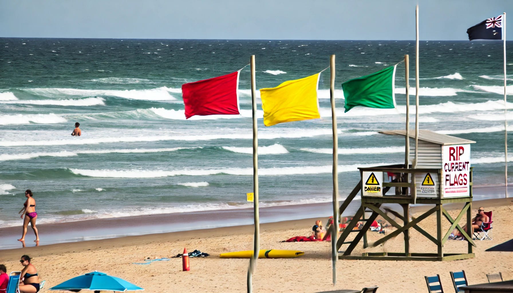
You’ll see these displayed on a beach in the form of a green, yellow, or red flag.
The NOAA model is one of the first of its kind, thus it has some of the same issues that befuddle many first-generation models - it’s too simple. In particular, it treats the wave action in all rip currents as essentially similar when, surprise, they aren’t. Since when is nature simple? In actuality, scientists have identified two types of rip currents: bathymetric and transient.
Bathymetric rip currents
Bath is a Greek root word meaning deep. Bathymetric rip currents are a type of rip current that forms due to variations in the underwater topography near the shoreline. These variations can create channels or deeper areas where water is funneled out to sea more rapidly than in surrounding areas. This leads to the formation of strong, narrow currents that pull water (and things in it) away from the shore.

Transient rip currents
A transient rip current is a type of rip current that forms temporarily and unpredictably, often in response to sudden changes in wave conditions or the interaction of waves with the shore. These changes create eddies that pull water out to sea. Unlike more persistent bathymetric rip currents, transient rip currents can appear and disappear quickly, making them particularly dangerous for swimmers.

A research team led by Dr. Audrey Casper (George Washington University) wanted to test how the model handled the two types of rip currents given that it wasn’t designed with them in mind. They studied the model’s rip current predictions against observations of the real thing made by beach lifeguards.
A little-known fact: To be a lifeguard, you must be able to swim, perform CPR, look good in a bathing suit (or not care), and be able to follow a strict scientific data collection protocol.
They analyzed lifeguard logs from Salt Creek Beach in San Diego from the summer and fall of 2021. The lifeguards were trained on a NOAA rip current strength scale, and trends in their data were checked against rescue data. They were also trained to report the behavior of the rip current, which the researchers used to classify the current as either bathymetric or transient. They collected about 70 observations, almost equally distributed between the two types of rip currents.
They found that the computer model was better at predicting bathymetric rip currents than transient ones. The difference was especially pronounced when the model indicated low and high chances of rip currents. However, the difference was not as strong during moderate levels of probability.
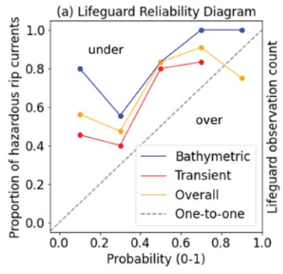
The research paper was actually more focused on the speeds of the currents rather than their presence. I point you to the paper for a more sophisticated analysis of that. However, their core finding was similar: the model did well for bathymetric currents and not as well for transient currents.
The researchers suggest that the model should be trained with localized data from more beaches (Kill Devil Hills is awesome and all, but its wave patterns may be unique) and enhanced with more sophisticated wave models that consider the directionality of the currents. They also propose using camera systems to collect more real-world observational data. Together, these changes should lead to more sophisticated models and, in turn, more accurate beach zone forecasts.
Don’t let rip currents deter a trip to your favorite beach. Be educated and aware of beach flag colors. But otherwise, have a good time, whether that means sipping a Corona, reading a book, surfing, or fighting emerging Godzillas.
And Now for Something Completely Different
Bryan Pfeiffer, in a recent Chasing Nature newsletter, eloquently wrote about the "tenacity and resilience" of some plant and insect species following a severe flood in Montpelier, VT, last summer.

A few weeks ago, we wrote about Mesoscale Precipitation Discussions and how they are used to forecast flash and severe flooding. I decided to pull up the MPDs for the Montpelier flood Bryan referenced. Below are the links. It is interesting how the terminology they use in the headlines goes from "concerning" to "significant" to "catastrophic”!
Now look at the time stamps. The escalation occurs over the course of about 7 hours! I would have loved to have been a fly on the wall in the MetWatch office that morning. Our best wishes to beautiful Montpelier and other Vermont communities. You can support their flood recovery efforts here.

We acknowledge Dr. Chad Kaufman for additional contributions.
Here's an interesting thought. Thinking about bathymetric rip currents on some beaches, caused me to think about fluid dynamics and wonder why should the atmospheric winds be any different in certain areas of land that have a distinct topography that encourages a backflow? There is a place in southern California where you can see shelf clouds moving inland between two high mountainous regions while a backflow is occurring between them! The cloud conditions have to be just right vtobmske this beautiful phenomena visible.