Some projects are simply gigantic. Their ambitions and scope inspire awe and admiration. For example, the $20 million campaign to convince people to pay for water.

How do such projects actually happen? I often feel soul-crushing despair when simply trying to coordinate a Zoom meeting. Some giant projects, like building spacecraft or moving entire interstate highways underground, succeed simply because the funding is so great that every branch of the decision tree can be pursued. Or the political eye is shining so brightly on it that even Sauron is jelly.
Convective Processes Experiment - Cabo Verde (CPEX-CV)
CPEX-CV is such a project. It’s so big that I could write a dozen individual WWAT newsletters about various aspects of the project. And I just might. But until then, this is a brief summary of the project as a whole and a highlight of one early result.
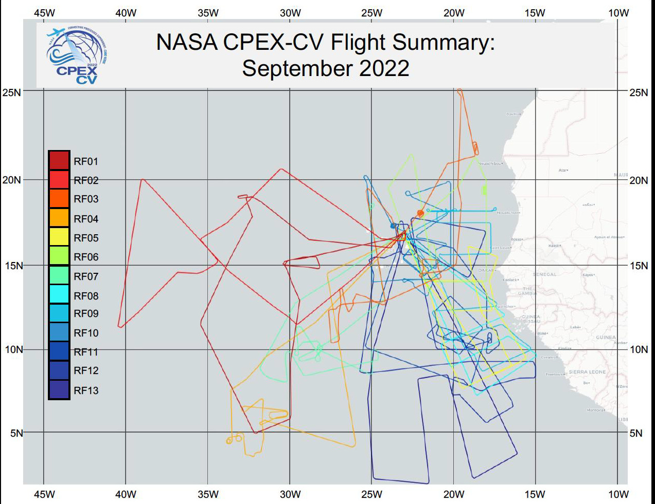
Funded by NASA, CPEX-CV was a field campaign aimed at collecting data to improve our understanding of eastern Atlantic tropical cyclone development. Based in Cabo Verde, an island nation off the west coast of Africa, this project studies a region of the Atlantic that is often the birthplace of trans-Atlantic hurricanes. Due to its remote location from the U.S. mainland, it has been relatively under-studied and poorly monitored.
Central to the campaign was the NASA DC-8 Airborne Science Laboratory. It carried state-of-the-art equipment to measure all sorts of atmospheric properties both remotely and in situ. These include thermodynamic, dynamical, and aerosol characteristics that affected the initiation and evolution of storm clouds in the region.
They needed a constellation of instruments to do this. It included (but was not limited to) the 532-nm high-spectral resolution lidar (HSRL) and 1064-nm elastic backscatter channels of the High-Altitude Lidar1 Observatory (HALO), Doppler Aerosol Wind Lidar (DAWN), the Airborne Third Generation Precipitation Radar (APR-3), High-Altitude Monolithic Microwave Integrated Circuit Sounding Radiometer (HAMSR), Airborne Vertical Atmospheric Profiling System (AVAPS) dropsondes, the Cloud Aersol Precipitation Spectrometer (CAPS), and the RDR-4000 X-band radar2.
Those instruments were deployed in 13 flights of the DC-8 which flew into the precursors to Hurricane Fiona, Hurricane Ian, and Tropical Storm Hermine. As if all these data weren’t enough, they coordinated their flights with passes of the Aeolus wind monitoring satellite, various meteorological ground stations, and launches of weather balloons.
A Dusty Example
Many have predicted this year’s Atlantic cyclone season to be one of the most active ever. Yet, so far, it’s been pretty quiet. One of the reasons for the lull in activity is the presence of Saharan dust in the atmosphere, which can inhibit tropical development by cooling the ocean and affecting wind patterns. More dust was present than anticipated this summer, limiting tropical development so far.

Three of the DC-8 flights were planned to study the dust-laden Saharan Air Layer. One of the flights discovered more water vapor within the dusty layers than expected, which could significantly impact estimates of the amount of heat transported by the dust. The researchers also found that the atmospheric layers carrying the dust were influenced by both horizontal and vertical wind shear. These findings challenged the existing theory that Saharan dust layers are dry and already well-mixed by the time they come offshore.
Polarization measurements revealed that the dust closer to the ocean surface was mostly spherical in shape, while dust higher in the atmosphere tended to be larger and coarser. The researchers suggest that the increased water vapor may reshape the dust as it rises in the atmosphere or that dust nearer the surface is already coated with water, making it appear more spherical than it is.
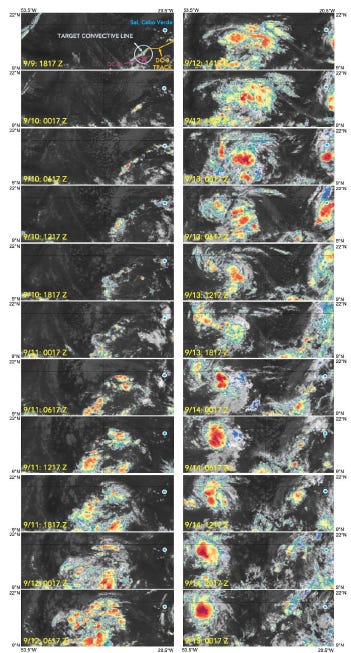
This same flight also sampled the atmosphere in a region of thunderstorms that later developed into Hurricane Fiona, one of the most destructive storms ever to hit Canada. The researchers will use this as a case study to explore how their new dust and other measurements relate to the storm’s formation.
Proof in the Pudding
A plot is worth a thousand words:
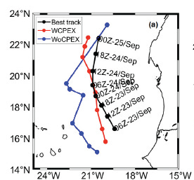
The CPEX-CV informed forecast was closer to the real track for Tropical Storm Hermine. So yay! It is but a hint as to the possible improvements the CPEX-CV data will have on understanding and forecasting East Atlantic tropical cyclone development. They have only scratched the surface of the data they collected, and I expect many more articles to be published in the coming years as this investment is amortized across h-indexes.
There Are Real People Behind This
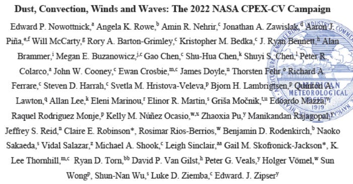
The spark of an idea starts somewhere in the human brain. In this case, 57 of them:
That is the authorship list of the paper. Notice the esteemed presence of Dr. Ed Zipser, who participated in CPEX-CV as part of his 40th field campaign.
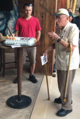
The paper’s authors also dedicated the paper to two late scientists who were critical to this work and unfortunately passed away too soon: Claire Robinson and Dr. Gail Skofronick-Jackson.
Need More Vitamin H in Your Blood?
If you like reading about hurricanes, many other Substack newsletters may interest you. Here are two that I subscribe to and enjoy reading:
This is not an advertisement or paid promo. I just think these are cool publications. However, if you want to pay us a gazillion dollars to shill for your 976-Psychic Weather Hotline… we’re listening.
And Now for Something Completely Different
I ran across this t-shirt at a local store in Chicago.
Could it really be inspired by actual events? Sadly, decades of the Internet have made me super skeptical of such claims. So I looked it up. Sure enough, such a weather pattern did occur earlier this year (2024):
Monday, Feb 26: Record-breaking heat was experienced in Chicago. The NWS issued a Red Flag warning.
Tuesday, Feb. 27: Continued heat. NWS warned of severe thunderstorms (threat level 2 of 5) and tornadoes (level 1 of 5).
Wednesday, Feb. 28: A cold front dropped temps by 40 degrees with light snow (this is the first time I’ve run across the phrase “adolescent low pressure system”).
Thursday and Friday: Calm and quite warm (for Chicago), with temps hitting the 60s the following weekend.
Yes, I bought the shirt.
We acknowledge additional contributions from Dr. Milind Sharma.
Plus, crucial additional data was supplied by balloon and satellite observations from domestic and international partners.



So the SAL pretty much put the kibosh on the mid Atlantic hurricane formation this year. This brings up a question: what would happen if because of increasing desertification, the dust increased and persisted later into the year? No more Atlantic hurricanes? Maybe no hurricanes in the Gulf other than CAG spin-offs?
An amazing report! thank you for sharing your research..